Loading page, please wait...
WhatsApp 24/7:+1 (302) 899-2888
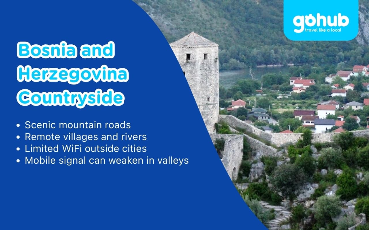
First-time travelers to Bosnia and Herzegovina often arrive with Sarajevo and Mostar in mind. Those cities are compact, historic, and easy to navigate.
Then they start seeing photos of the countryside.
Emerald rivers. Ottoman stone bridges. Quiet mountain villages. Lakes surrounded by pine forests. Suddenly, the plan expands.
Exploring the Bosnia and Herzegovina countryside sounds simple. Rent a car. Drive. Stop wherever it looks beautiful.
In reality, it can feel less predictable.
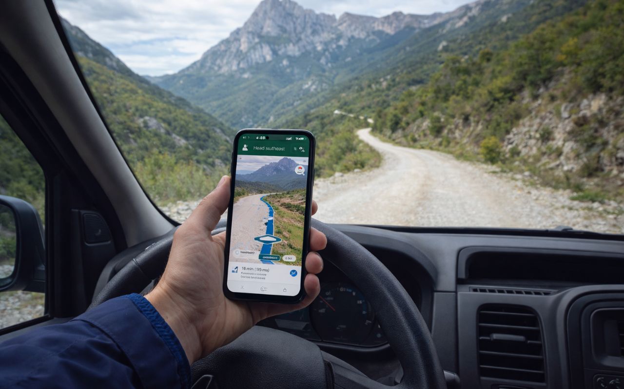
Road signs are sometimes minimal. Mountain routes twist through remote areas. Public transport becomes infrequent outside major towns. And mobile connectivity can shift quickly once you leave urban centers.
For travelers who enjoy independence, this mix of beauty and unpredictability is part of the charm. But it also requires preparation.
TL;DR
The Bosnia and Herzegovina countryside offers mountains, rivers, and quiet villages beyond Sarajevo and Mostar.
Roads can become narrow and winding once you leave major highways.
Public transport is limited in rural areas, so many travelers rent a car.
WiFi is common in cities but less reliable in villages and national parks.
Mobile signal may weaken in mountain valleys and forested regions.
Offline maps and stable mobile data help reduce stress during countryside road trips.
The countryside in Bosnia and Herzegovina is not designed for mass tourism. That is part of its appeal.
But it also creates uncertainty.
Here is why travelers often feel unsure once they leave the main cities:
Within two hours of Sarajevo, landscapes shift from valleys to mountain passes.
Rivers cut through narrow gorges. Villages appear and disappear between hills. GPS routes may suggest small regional roads that are technically paved but very narrow.
Outside larger towns, you may notice:
Fewer petrol stations
Limited English signage
Inconsistent public transport schedules
Restaurants that close earlier than expected
The official tourism portal of the Tourism Association of Bosnia and Herzegovina provides regional information, but once on the road, real-time planning becomes more important.
Mountain regions such as Sutjeska or areas near the border with Montenegro can experience sudden weather shifts. Fog and rain reduce visibility quickly.
This makes navigation and real-time map access more important than many travelers expect.
Before discussing logistics, it helps to understand why so many travelers venture beyond cities in the first place.
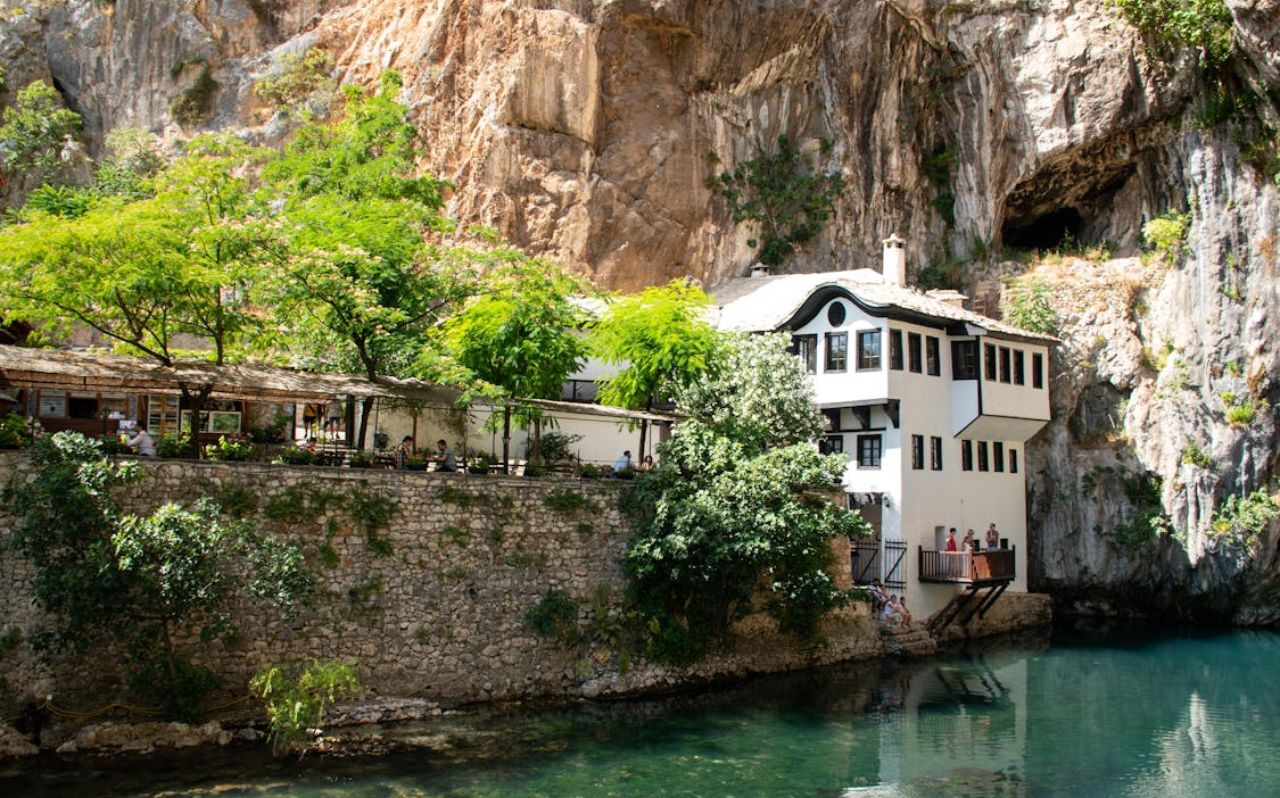
Blagaj sits about 15 minutes from Mostar. The iconic Tekke monastery rests at the base of a cliff where the Buna River emerges.
The setting feels peaceful, especially in the early morning. However, parking can be limited and local WiFi is not always reliable in outdoor café areas.
Sutjeska is Bosnia’s oldest national park. It includes Perućica, one of Europe’s last primeval forests.
Hiking routes are well-marked, but not always digitally mapped in detail. Signal coverage may weaken as you move deeper into forested areas.
Official park information is available through the Sutjeska National Park website.
Located near the Croatian border, Una National Park is known for waterfalls and rafting routes.
Road access is generally good, but remote entry points sometimes lack clear signposts. Navigation apps become essential here.
Exploring rural Bosnia works best with a simple structure.
Public buses connect major cities. However, rural villages and parks are often reachable only by car.
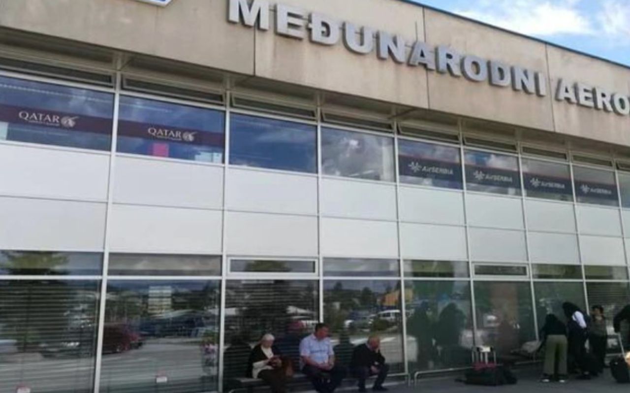
Many travelers pick up vehicles near Sarajevo International Airport and begin their road trip from there.
Google Maps allows offline downloads. This is particularly useful in:
Mountain roads
Border regions
National parks
Offline maps work for navigation, but they do not show real-time traffic updates.
Rural guesthouses sometimes lack clear street numbers. Saving the exact map pin avoids confusion at night.
In smaller villages, English may be limited. Translation apps help with menus, directions, and local questions.
This is where many travelers underestimate the situation.
In cities like Sarajevo and Mostar, connectivity feels stable. Cafés offer WiFi. Hotels provide passwords. Mobile signal is generally strong.
Once outside urban areas, things change.
Travelers typically rely on data for:
Turn-by-turn navigation
Checking weather updates
Translating menus
Confirming accommodation details
Coordinating with hosts
In rural areas, this usage becomes constant rather than occasional.
Public WiFi outside cities can be:
Slow
Password-protected
Limited to indoor spaces
Unavailable in parks and hiking zones
National parks rarely provide public internet access at trailheads.
These scenarios are frequent:
Arriving at a guesthouse after sunset and not finding the entrance
Losing signal mid-route in mountainous terrain
Needing to contact a host but not having working data
Trying to reroute due to a road closure
Bosnia’s primary mobile operators include BH Telecom and HT Eronet. Coverage is generally strong in populated areas, but less consistent in sparsely populated mountain zones.
Coverage maps are available on carrier websites, but real-world conditions vary with terrain.
In practice, countryside exploration often means you cannot depend on café WiFi alone.
For travelers staying only within Sarajevo and Mostar, hotel WiFi may be sufficient.
For those planning to explore rural regions, drive between villages, or hike in national parks, a more stable mobile setup becomes worth considering.
In situations like this, having a reliable travel eSIM for Bosnia and Herzegovina can reduce stress and help travelers stay connected throughout their trip.
This is not about constant streaming or heavy usage. It is about practical navigation, communication, and safety when infrastructure is limited.
Yes, driving is generally safe. Roads are paved, but some are narrow and winding. Mountain routes require attention, especially in poor weather.
No, most national parks do not provide public WiFi. Mobile data is typically the only option for connectivity during hikes.
Signal is strong in towns and along main highways. In deep valleys and forested areas, it can weaken or temporarily disappear.
Public buses connect larger towns. However, many rural attractions require a car for convenient access.
Offline maps are still helpful. They provide backup navigation if signal drops unexpectedly.
The Bosnia and Herzegovina countryside is one of Europe’s quieter travel experiences.
It offers space, nature, and villages that feel untouched by mass tourism. That freedom is part of its appeal.
But it also means infrastructure is lighter. WiFi is less common. Roads can feel isolated.
Planning ahead does not reduce the adventure. It simply removes unnecessary stress.
For many travelers, the difference between a smooth countryside trip and a frustrating one comes down to practical preparation. Connectivity is part of that preparation.
When treated as infrastructure rather than luxury, it quietly supports the entire experience.
For a broader overview of routes, borders, and regional planning, explore our practical guide on how to travel to Balkan countries before mapping out your countryside trip.