Loading page, please wait...
WhatsApp 24/7:+1 (302) 899-2888
Colombia has become one of Latin America’s most talked-about destinations. According to ProColombia, the country welcomed more than 5 million international visitors in recent years, reflecting steady growth in tourism across major cities and regional destinations.
Official tourism data is available through the Colombia tourism authority: https://colombia.travel/en
For first-time visitors, that popularity is both reassuring and slightly intimidating.
Traveling through Colombia often means moving between very different environments. Bogotá sits high in the Andes. Medellín lies in a valley surrounded by mountains. Cartagena rests on the Caribbean coast. The coffee region feels rural and slow-paced. Tayrona National Park offers jungle and beach landscapes.
On a map, distances may not look dramatic. In practice, geography changes everything.
Traveling through Colombia is very manageable. It simply requires realistic expectations, especially when moving between cities.
TL;DR
Colombia’s geography makes travel times longer than they appear.
Most multi-city trips involve flights or long-distance buses.
Major cities are well connected. Rural areas can feel slower and less predictable.
WiFi works in urban areas but is inconsistent on travel days.
Mobile data is commonly used for maps, transport apps, and coordination.
If you are still weighing safety concerns before booking your trip, this detailed guide on is Cartagena safe for first-time travelers walks through neighborhoods, common situations, and what to expect on the ground.
Before planning routes, it helps to understand why this country feels more complex than it first appears.
Colombia’s Andes mountain range runs through the country. Roads wind through hills and valleys. Travel that appears short on Google Maps can take much longer due to terrain and weather.
A route that looks like a simple four-hour drive may stretch into eight or more hours by bus. Mountain fog and heavy rain can slow journeys further.
For first-time travelers, this often comes as a surprise.
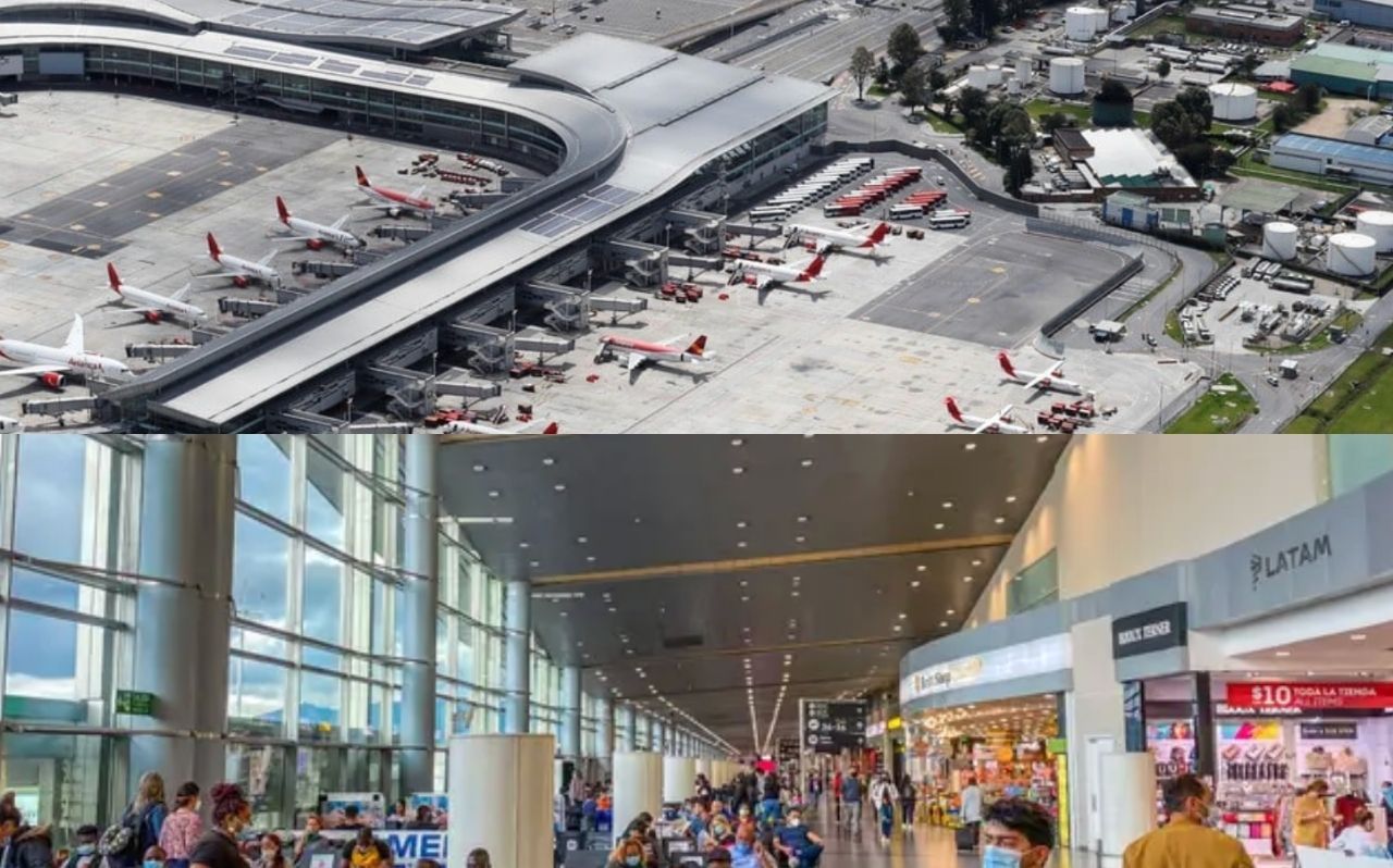
Colombia has an active domestic flight network. Major airlines operate frequent routes between Bogotá, Medellín, Cartagena, and Santa Marta. El Dorado International Airport in Bogotá is one of the busiest airports in Latin America. Official airport information can be found here: https://www.eldorado.aero/en
Flights are common for travelers covering longer distances.
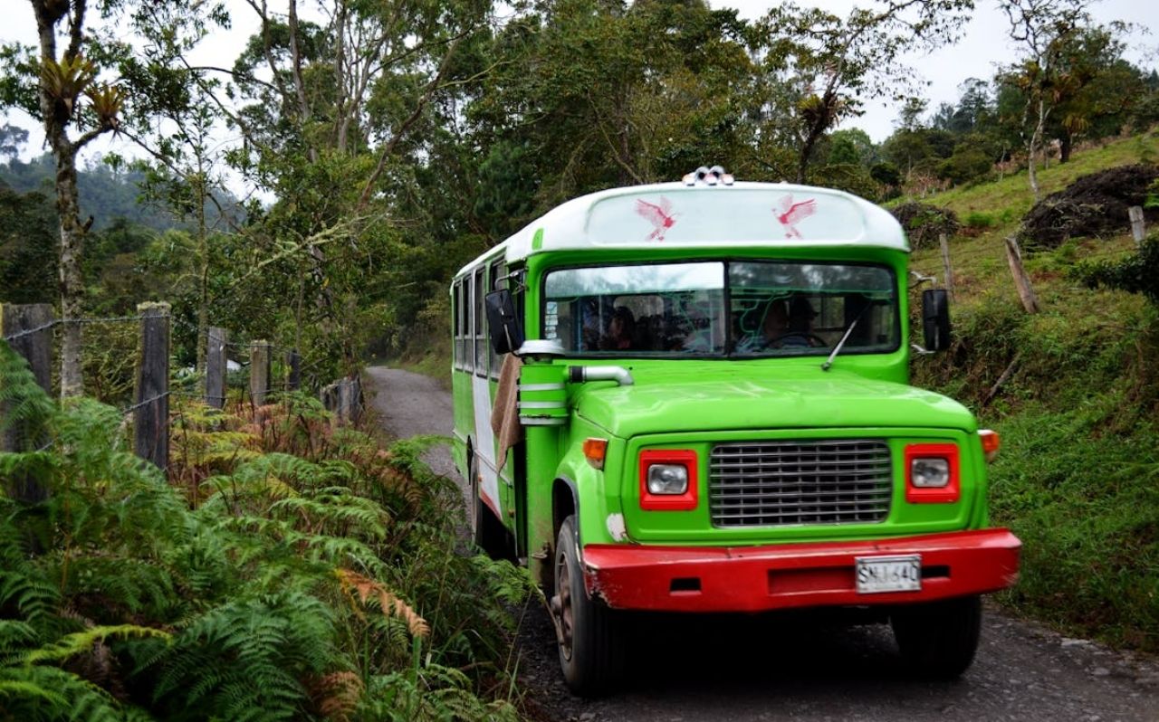
Long-distance buses remain widely used. Some journeys between cities can take 8 to 12 hours. Overnight buses are available, but they can feel tiring for those not used to extended road travel.
Choosing between flight and bus often depends on budget, schedule, and comfort.
Colombia’s major cities are accustomed to tourism. However, many first-time visitors carry concerns about safety.
In practice, travelers tend to feel comfortable in well-known neighborhoods. Stress usually appears during transitions. Late-night arrivals, unfamiliar bus terminals, or unclear transport connections can create uncertainty.
The country is navigable. The key challenge is managing logistics calmly.
To reduce uncertainty, it helps to look at the most common travel flows between cities.
This is one of the most traveled routes.
Flight time: about 1 hour
Bus time: typically 8 to 10 hours
Flights are often preferred due to mountainous roads. Upon arrival in Medellín, travelers usually rely on ride-hailing apps or taxis to reach neighborhoods such as El Poblado or Laureles.
This route connects the Andean interior with the Caribbean coast.
Flight time: around 1 hour 15 minutes
Bus time: 12 hours or more
Cartagena’s historic center is compact and walkable. However, airport transfers require coordination, especially during busy travel seasons.
Tayrona National Park is one of Colombia’s most visited natural areas. Official park information is available through Colombia’s national park authority: https://www.parquesnacionales.gov.co
Travelers typically take a short bus or taxi from Santa Marta to the park entrance. Inside the park, infrastructure is limited. Walking trails connect beaches and eco-lodges.
Signal coverage can vary within the park.

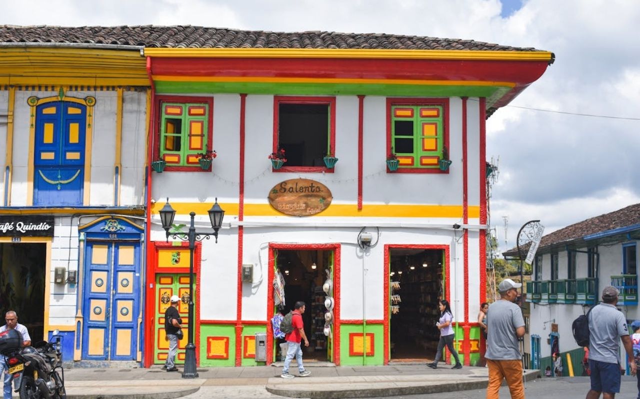
Salento and nearby towns in the coffee region offer a slower rhythm.
Transport options include regional buses and shared vans. Schedules may be less frequent compared to major city routes. Travelers often coordinate tours locally upon arrival.
This region rewards patience and flexible planning.
With geography and routes in mind, small preparation steps can make transitions smoother.
Domestic flights are commonly booked through airline websites or travel apps. Bus tickets can be purchased at terminals or via official operators.
Schedules may shift due to weather or operational delays. Checking departure times on the day of travel is common practice.
Late arrivals create the most stress for first-time travelers.
Practical steps include:
Saving the accommodation address offline
Confirming transfer details in advance
Keeping transport app options ready
These details help reduce confusion after long travel days.
Many journeys involve multiple steps. A traveler may move from hostel to taxi, from taxi to airport, from airport to new hotel.
In busy terminals, WiFi networks may be slow or overloaded. Having key booking details accessible offline can prevent last-minute problems.
Understanding connectivity in real travel situations helps set realistic expectations.

Mobile data is typically used for:
Navigating unfamiliar neighborhoods
Ordering ride-hailing services
Confirming flight gates or bus platforms
Translating conversations
Messaging hosts via WhatsApp
In large cities like Bogotá and Medellín, public WiFi exists in cafes and hotels. However, connectivity becomes more critical during transitions.
An airport arrival without data can feel disorienting. A delayed bus with no updates can increase stress.
WiFi reliability varies significantly by location.
Bus terminals can have unstable connections.
Mountain highways may lose signal entirely.
Smaller towns may offer slower speeds.
Tayrona National Park has limited coverage in some areas.
Even in cities, hostel WiFi can slow down during peak evening hours.
In practice, travelers often rely on mobile data during active travel days rather than sightseeing days.
Common scenarios include:
Losing signal while navigating mountain roads
Arriving at a terminal with limited signage
Needing to verify accommodation details quickly
Overloaded hostel WiFi when everyone connects at night
These are not dramatic situations. They are simply part of moving through a diverse country.
Planning ahead reduces stress.
Traveling through Colombia often involves long transfer days and unfamiliar transport systems.
In situations like this, having a reliable travel eSIM for Colombia can help reduce stress while moving between cities.
Many travelers visit Colombia independently each year. Major tourist areas are accustomed to visitors. As with any destination, situational awareness and practical planning are important.
Flights are common for long distances. Long-distance buses are widely available and connect most regions. Travelers often choose based on schedule and comfort.
WiFi is generally reliable in major cities and hotels. It can be inconsistent in rural areas, bus terminals, or national parks.
Mobile data is commonly used for maps, ride-hailing apps, messaging, and travel updates. It becomes especially useful during airport arrivals and intercity transfers.
Signal coverage inside Tayrona can vary. Some areas have limited connectivity due to terrain and infrastructure. Travelers should not rely entirely on strong signal inside the park.
Traveling through Colombia offers varied landscapes, vibrant cities, and distinct regional cultures. The experience feels richer when expectations match reality.
Understanding geography, transport patterns, and connectivity helps first-time visitors move confidently between destinations.